October 28, 2015
Photogrammetry and UAVs
Technology can sometimes seem too abstract to completely appreciate.
Clients often don’t know what to expect after their first stockpile measurements, even after we explain it to them. That’s why the Stockpile Reports Sales and Support team often gives new clients a peek behind the scenes about what happens after their data is uploaded to our system. They are usually very delighted when they view their first 3D stockpile model online, and see the results of photogrammetry. As the saying goes: Seeing is believing!
What is Photogrammetry?
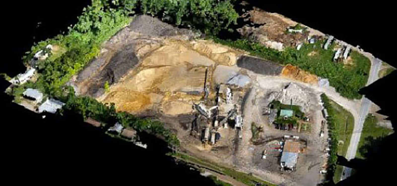
Photogrammetry is the art and science of obtaining precise mathematical measurements and three-dimensional (3D) data from two or more photographs. The term “photogrammetry” is derived from three Greek words: ‘photos’ meaning ‘light’, ‘gramma’ meaning ‘which is drawn’, and ‘metron’ meaning ‘to measure’. It is the science and technology of generating 3D information from 2D measurements.
It is astonishing to think that this science has existed since the 1860’s! Employing photogrammetry for commercial usage has become much more popular recently.
Current Usage
Who hasn’t heard or read about drones? It is difficult to avoid news about UAVs (Unmanned Aerial Vehicle), commonly referred to as ‘drones’. Although the use of drones in photogrammetry and lidar mapping is still in the very early stages, interest in utilizing drones for various applications has exploded.
The broad definition of a UAV covers balloons, kites, gliders, airships, rotary and fixed wing types. These have the capability for photogrammetric data acquisition in manual, semi-automated and automated flight mode.
Aerial photogrammetry is achieved by drone and by plane. This is done by mounting a camera either to, or inside an aircraft and is usually pointed vertically towards the ground. Multiple overlapping photos of the ground are taken as the aircraft flies along a flight path.
However, it isn’t just the flight path that matters to obtain a good photogrammatic result. If the photo imagery isn’t sharp, then the quality of a rendered 3D model suffers. Small features would be blurry if you were to zoom in on an aerial photo.
There is also close-range photogrammetry, where the camera is close to the subject, with an object-to-camera distance of less than 300 meters. Traditionally, this has applied to photographs using hand-held cameras, on a tripod, or on a vehicle.
The maximum flying height by commercial drones with a Section 333 license above populated areas, as required by the FAA is below 300 meters, so measuring by UAV would also be an example of close-range photogrammetry as well.
The same basic principles apply to photographs taken from a camera mounted on a tripod (terrestrial) and also to UAVs and cameras suspended from light sport aircraft (low level aerial). The photo imagery must be sharp to provide the basis for a good 3D output.
As of October 22, 2015, there are currently 2020 petitions for Section 333 Exemptions that have been granted by the FAA.
Applications for UAV photogrammetry
The most common use is for mapping. Examples include:
- Orthophoto’s (geospatially corrected aerial images)
- 3D Building Models
- Contour Maps
- Planemetric features such as road edges and heights, signs, building footprints, etc.
- 3D vegetation modelling
- Volumetric Surveys
Industries that benefit from having 3D models include:
- Forestry Management and Planning
- Flood Modelling
- Pollution Modelling
- Mapping and Cartography
- Urban Planning
- Coastline Management
- Transport Planning
- Oil and Gas Exploration
- Quarries and Minerals
- Archaeology
- Cellular Network Planning
Stockpile Reports is experienced at processing the data collected from flying an Unmanned Aircraft System (UAS) or UAV (Unmanned Aerial Vehicle). We’ve been measuring stockpiles by UAV since 2013, in countries where this method is already accepted and regulated.
We are happy to assist clients with stockpile measurements taken via UAV, ensuring that the data captures optimal imagery, generating excellent results. We are also very experienced at piloting and operating various UAS models.
Contact us for more information about our reporting using UAVs. If you’d like to read more about photogrammetry in everyday life, check out another blog post.
Stay In the Know
Be the first to know about the latest Stockpile Reports news and features.