Drone-based GIS functionality to support business functions, such as mapping for mine planning and inspections, are important. Some drone GIS solutions also tout stockpile measurement as a feature, however, these “solutions” require a substantial amount of manual work and are prone to misuse. With Stockpile Reports®, we measure Every Pile in the bulk materials ecosystem to give answers you need in real-time. Capture imagery from a phone, drone, or installed camera and we give you the answer.
The Problem With Drone GIS Solutions
CEO and Founder, David Boardman, is passionate about Stockpile Reports’ easy-to-scale, comprehensive solution because bulk materials measurement is a business problem that won’t go away.
“The challenges of bulk materials inventory are real. You can’t put a bar code on a pile of rock. “Do it yourself” counts where Bobby flies the drone result in measurements that are not consistent or independent. Without controls over assumptions like conversion factors and base planes, the reliability of that measurement goes out the door. If I was a CFO, I wouldn’t want to bet my job on financials that weren’t backed by a measured number! And with Stockpile Reports, anyone can capture imagery from a phone, drone, or installed camera and get the answer, no knife and fork GIS nonsense.”
We frequently help customers transitioning from a drone GIS solution. Often, pile measurement services are marketed as a way to combine internal GIS requirements and inventory management to save money. What is not discussed is the “knife and fork” to make it work, a manual pile identification and review.
The other dirty secret is that because the drone GIS measurement process is internally managed and requires a human interface, the results can be manipulated, putting the reliability of your financial statements at risk. Stockpile Reports takes a fraction of the time to execute because our proprietary digitization technology does the work for you. And inventory is reported with consistency, control, and trust.
How is Stockpile Reports NOT a Drone GIS Tool?
#1 Automation
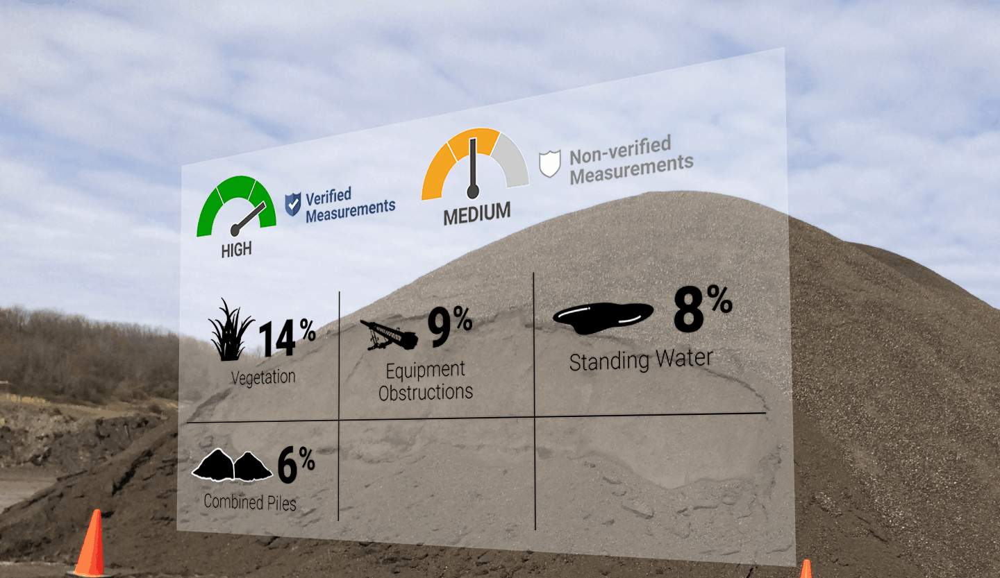
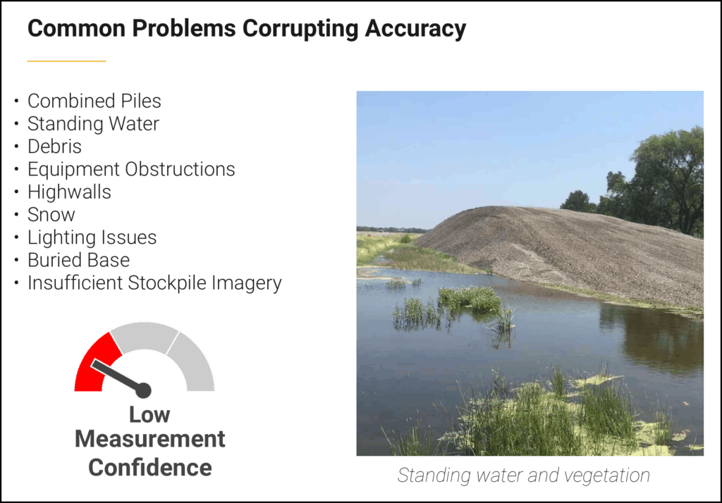
No clicking on piles required: Automation drives consistency because Stockpile Reports’ advanced algorithms convert images of stockpiled bulk materials into accurate and precise measurements. Our method removes internal bias and manual errors, establishing the foundation for a consistent and reliable process to support financial values. Stockpile toes and surfaces are automatically calculated and scored. Obstructions are systematically identified and addressed.
#2 Control
Independent reports come from a controlled process: Company policies for conversion factors and specifications about products and piles are highly controlled as to when and who modifies these subjective assumptions. If you or someone on the team doesn’t like the answer – sorry, you can’t change it! We manage technical inquiries with a transparent dispute resolution process.
#3 Confidence Scoring
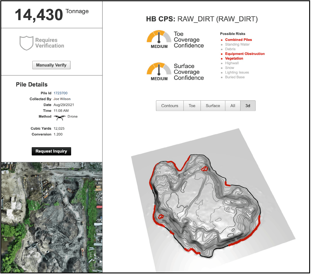
Our patented technology produces reports that provide a surface score and measure confidence in toe and base calculations. For example, the biggest contributor to the volume of a pile is the determination of the base plane and our algorithms assess the accuracy of this measurement.
Stockpile Reports helps customers reduce inventory write-offs, while also creating a scalable, controlled, and efficient process that doesn’t deplete internal resources or create delays with financial reporting disputes. Stockpile Reports’ customers understand this value. As one member of an international road construction group expressed, “the more we measure, the better we get”.
About Stockpile Reports
Stockpile Reports is a vertically integrated service for logistics and inventory management of bulk materials at scale, digitizing images of bulk materials to solve problems with accurate perpetual inventory and supply chain planning. Every Pile, Any Time®.
Stockpile Reports uses EveryPoint, a Physical AI platform that supports infinitely scalable data collection and processing for the next generation of Physical AI applications and services. EveryPoint has been building Physical AI solutions at scale, ranging from rapid 3D processing of massive image datasets to global logistics and inventory management solutions. Use EveryPoint to bring Physical AI to your applications and services.